A Hiker's Guide to the Hokkaido East Trail, Japan's New Long-Distance Trek

A Hiker's Guide to the Hokkaido East Trail, Japan's New Long-Distance Trek

Author Photographer
  • Sam Godin

Camera
  • Fujifilm GF670, Ricoh GR1s
Film
Far from the frequently visited stops on Japan's north island, the country's newest long trail is a 250-mile walk in Hokkaido parts unknown

Published: 11-20-2025

Hokkaido East Trail Stats

Total Distance: 410km / 254 miles
Total Elevation Gain: 6,156m meters / 20,196 feet (NOBO)
Average Completion Time: 20 to 30 days
Recommended Direction: South to North (Kushiro to Rausu)
Google Maps Route


Hokkaido, Japan’s northernmost island, is best known for the massive amount of snow it receives in winter and the legendary ski conditions that come with it. But what some visitors may not realize is that when all that snow melts, Hokkaido transforms into an equally incredible destination in late spring, summer, and autumn with seven national parks, five quasi-national parks (these parks that lie somewhere between a state park and a national park), and since 2024, a brand new long-distance hiking trail called the Hokkaido East Trail (HET).

Most of those familiar with Hokkaido probably know of cities like Sapporo, the island's largest city, and the ski capital of Niseko. Both are situated in the west, but the HET is located in the less-visited eastern half of the island. Known locally as Dōtō (“dō” for Hokkaido and “tō” for east), the HET stretches 410 kilometers (~254 miles) from the southern coastal marshlands of Kushiro to the remote northern fishing port of Rausu in Shiretoko National Park, one of Japan’s most wild and rugged regions.

Sam-Godin-hokkaido-east-trail-Lake-Kussharo

Lake Kussharo

Seasoned thru-hikers may see 410 kilometers as relatively short, but the length makes the HET a manageable route for those hoping to complete the entire trail in one trip. With an average completion time of about one month, it fits neatly into a late-summer itinerary.

To find out what Japan's new long trail had to offer, I spent several days traveling the length of the HET in September and again in early November. What I discovered was a trail shaped as much by the people who live along it as by the varied landscapes it traverses. Along the Hokkaido East Trail, you'll encounter dairy farms and potato fields, jazz bars in quiet countryside towns, steaming volcanic calderas, beer vending machines lighting up lobbies of public onsens, and plenty of “watch out for bears” signs.

In this guide I'll break down everything I learned along the Hokkaido East Trail, including itinerary highlights, tips for hiking it during the late summer and early fall, and some region-specific gear intel to keep in mind.

Sam-Godin-hokkaido-east-trail-Tsutsujigahara

Tsutsujigahara

Concept and Composition of the Hokkaido East Trail

The Hokkaido East Trail was established in October 2024 after a two-year collaboration period between the Ministry of the Environment, guiding associations in eastern Hokkaido, and the Trailblaze Hiking Institute, a Tokyo-based ecotourism consultancy. Although regional hiking routes already existed in the area, the HET connects several of them into a single north-south mega trail.

The HET's southern terminus starts in Kushiro on the southeastern coast of Hokkaido and winds 60 kilometers through Japan’s largest wetlands and Kushiro Shitsugen National Park before reaching the vast prairielands of Shibecha and Isobunnai.

After arriving at the centrally located Teshikaga, the trail splits, allowing hikers to choose to hike another 60-kilometer section deep through the forested roads of Akan-Mashu National Park towards Mount Meakan or continue north to the twin caldera lakes of Lake Kusharo and Lake Mashu. Heading north from the calderas means another 45-kilometers through forests and potato fields to the outskirts of the northern coastal town of Shari, where you’ll see the Sea of Okhotsk and travel along a windy coastline towards Utoro, gateway to Shiretoko National Park. Here it is a steep 742-meter climb to Shiretoko Pass and finally a descent to the northern terminus port city of Rausu.

sam-godin-hokkaido-east-trail-Rausu

Rausu

Like other established long hiking trails in Japan, like the Michinoku Coastal Trail, the HET puts emphasis on human connection as much as the natural beauty. Roughly 70% of the HET is asphalt and gravel roads. This may come to a surprise to any long trail hiker familiar with the taboo of “yellow blazing”—a term used for when a thru hiker walks a paved road to avoid a difficult section of trail—but it creates a unique experience closer to the Camino de Santiago in Spain, a walk that blends trail with towns and culture.

The road sections also make the route easily adaptable. It can be tackled as a thru-hike, broken into shorter section hikes accessible by car, or reimagined as a bikepacking route. For the first half, where the trail parallels the 160-kilometer (100-mile) Kushiro River, a hybrid packrafting trip is even possible.

Takahiro Ogino, the representative director for the Hokkaido East Trail and my hiking partner during my time in Hokkaido, explained to me that the goal was to encourage interaction between hikers and local communities. While campsites exist, the trail is designed so travellers can spend many nights at inns, hotels, or minshuku (family-run guesthouses), which naturally creates opportunities to meet people along the way.

Case in point, on my final night in the area in September, Takahiro and I ended up at a small jazz bar next to our inn and found ourselves swapping stories with the 87-year old owner and a couple of regulars while drinking some Sapporo Classic lagers (a version of the famous beer you can only get in Hokkaido).

Sam-Godin-hokkaido-east-trail-sapporo-classic

Hiking the Hokkaido East Trail in Late Summer

Pleasant Temperatures

Ask anyone who has visited Japan in the summer and you’ll hear about how hot and humid it can get there. There are two classic ways to escape this muggy fate—head to the mountains or head north to Hokkaido. On the HET, September evenings had me pulling on my alpha fleece even while Tokyo temperatures lingered in the 90s.

Fewer Horseflies

Choosing the shoulder month of September also helps you avoid the peak season for horseflies, which thrive near the many ranchlands and wetlands in midsummer. (Pro tip: Avoid wearing black if hiking in the warmer months, as many of the pests are attracted to darker clothing colors.)

sam-godin-hokkaido-east-trail-Tawadaira-Campsite

Tawadaira Campsite

Tent Camping

During late summer most of the tent locations are still open as well, making it a perfect time to use the campsites and save some money on lodging. I stayed at the campsites at the base of Mount Meakan and in the prairie fields of Tawadaira for some beautiful evenings under the stars.

Bears!

One factor hikers can’t avoid, though, is bears. Hokkaido is home to the Ussuri brown bear, a smaller relative of the grizzly that's significantly larger than the black bears found in other parts of Japan. Encounters aren’t common, but Shiretoko National Park in the northern half of the trail is known for its bear population, and an attack occurred deeper in the national park just a week before my September visit. Limiting bear encounters is another reason that much of the trail has been placed alongside roadways. Carrying bear spray is strongly recommended, and most hikers use bear bells to avoid surprise encounters—the worst-case scenario for both bear and human. The official HET trail group created a map of places where you can even rent bear spray and bear containers for your trip.

sam-godin-hokkaido-east-trail-Karamatsu-Fall

Karamatsu in the fall

Hiking the Hokkaido East Trail in Late Fall

Colder Temps & Shorter Days

If hiking Hokkaido in September brings hot days and chilly evenings, hiking in late October gives you chilly days and freezing temperatures once the sun goes down. You’ll want to pack a warmer loadout if considering hiking the HET in late fall.

As on any trail during the colder months, you’ll be contending with shorter days and longer nights. When I visited, the sun set around 4:30 PM, which meant reaching the next shelter felt more urgent each day compared to my previous trip.

Onsen Season

The colder temperatures made the hot springs along the route feel especially rewarding—there’s nothing quite like soaking in a steaming bath after a day of walking. The HET could easily double as an onsen trail, since much of eastern Hokkaido sits on volcanic ground and hot springs are never far from the trail. On one of the colder November days I took a minute to rest my feet in one of the few ashiyu, a small onsen for your feet. During my soak, I learned about the city from a local who was also using the onsen.

A note about the onsens: I didn’t see any signage prohibiting tattoos at the baths I visited (a few were even natural and unmanned), but it’s always best to ask beforehand. Japan traditionally associates tattoos with organized crime, and some facilities still request that they be covered in public baths.

sam-godin-hokkaido-east-trail-Sweet-Potatos-Karamatsu

Farms along the HET

Fall Foliage & Local Harvests

By November, the fall colors set the region ablaze, with Japanese larch (karamatsu) trees lining the farm fields and mountains turning a striking golden yellow. Walking between bright green sugar beet fields and the glowing larch forests sometimes felt more like the English countryside than northern Japan. A local farmer I passed one day clarified that the towering piles of rocks I kept seeing next to the fields were actually mounds of sugar beets drying before they'd be sent off and processed into sugar.

Hiking the HET in the Winter

It's inadvisable to hike the full length of the HET once winter sets in since road closures and snow make travel difficult—somethign I was constantly reminded of by the red and white arrows floating above the region's roads, which show snow plows where the curb is when it's buried. The official HET recommended months are May to October. Section hikes and national park visits remain entirely possible though, and winter has its own draws, like walking on the drift ice that forms along the coastline near the northern section of the HET.

Highlights of the Hokkaido East Trail

While I didn’t get a chance to walk the full length of the trail in a single journey, I did get to see most of the major stops. These are a few of the locations I found most interesting.

sam-godin-hokkaido-east-trail-Lake-Kussharo-2

Akan-Mashu National Park

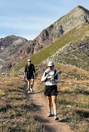
At the center of the HET, Akan-Mashu National Park is a land of calderas, onsen villages, and primeval forests. You can find the Mashu-Kussharo Trail (MKT) here as well, a 62.5-kilometer (38-mile) regional hiking route that has now been incorporated into the HET. The Mashu-Kussharo Trail runs along the rim of Lake Kussharo's caldera and through groves of dwarf bamboo, which carpet the low-laying mountains in the area. Walking the MKT, I was able to see both the caldera in its entirety and as far as the Pacific Ocean, a unique sight you can’t experience anywhere else in Japan. Two other regional trails in the area that the HET has incorporated are the 25-kilometer Kushharo Caldera Trail (KCT) and the 43-kilometer Uramashu Outer Rim and Kaminoko Pond Trail, both of which are excellent trail running routes.

Another highlight is the short Tsutsujigahara Nature Trail, where Labrador tea shrubs thrive in the acidic volcanic soil. We walked a portion of this trail from the Kawayu Nature Center to Mt. Io, an active volcano with yellow tinted sulfur geysers dotting the mountainside.

Because of the geothermal activity, hot spring villages like Kawayu Onsen and Akanko Onsen are popular nearby. Akanko is especially worth visiting, as it's one of the few places where visitors can experience Ainu cultural museums dedicated to the indigenous people of Hokkaido. It's worth checking out, even if it is a little touristy. Keep an eye out for the bizarre green algae spheres, called marimo, found in the nearby lake.

sam-godin-hokkaido-east-trail-Akan-Mashu-Ridgeline

Akan-Mashu Ridgeline

Mount Meakan

Mount Meakan is a grouping of eight volcanos in Akan-Mashu National Park and is the end goal of the deutour route that branches from Teshikaga City in the middle of the HET. The six-hour round trip day hike is technically not part of the HET, but the views of the pristine blue lake at the summit contrasted with the orange rocky peak make it well worth the effort. If you plan to go, the Onneto campground at the base of the volcano is a good spot to start the hike. There’s a walking path from the campground to the nearby Onneto Hot Spring Waterfall, too.

Utoro City

The small fishing village of Utoro can be found near the end of the HET and is the final city before the trail's terminus in the northern port of Rausu. Utoro is the last stop before Shiretoko National Park, which translates to “end of the world” in Ainu, and Utoro sure feels like it’s on the edge of Japan. There's nothing like being blasted by northern winds from Russia on the highway portion of the HET here to wake you up (don’t forget a wind jacket for this area). During my stay I caught some incredible sunsets over the Sea of Okhotsk, sampled unbelievably fresh seafood (try this spot), and ducked into hole-in-the-wall bars (like this one) with locals. As you cross over the dozen-plus bridges leading up to Utoro, make sure to check below since you can often see families of salmon making their way upstream if your timing is right. On this section of the trail you may just catch a glimpse of Stellar’s sea eagle, the world’s largest eagle, too.

sam-godin-hokkaido-east-trail-seafood

Not your average trail meal

sam-godin-hokkaido-east-trail-Utoro-Sunset

Sunset in Utoro City

Gear You Should Bring on the HET

The HET may not be as long as some other long trails, but in order to hike comfortably and safely you’ll need to be prepared for sometimes drastic temperature changes. Hokkaido is one of Japan’s wildest landscapes and even when you’re not on a ridgeline you should be ready for shifting weather. Fortunately, if you forgot something essential, there are plenty of Montbell locations around Tokyo and other major cities in Japan to buy gear. While you're over there, you can even shop from some of our favorite Japanese outdoor brands.

Carrying bear spray is a must, even if it's just in case. They're not as common in the US, but hikers in Japan swear by bear bells that you attach to your backpack—picking one up at a visitor center or Montbell store and letting it ring along the forested sections isn’t a bad idea. As the days get shorter towards autumn you’ll want a headlamp in case you find yourself between lodgings as it gets dark. Bring a water filter if you plan on roughing it, since Hokkaido is one of the only areas of Japan where a water filter is absolutely necessary due to a fox-borne parasite that's unfortunately common in the area.

sam-godin-hokkaido-east-trail-Bear-Spray

Carrying bear spray is a good idea

When it comes to what to wear, you’ll want to pack layers. During both trips I brought a shell layer (this packable, lightweight jacket from Warbonnet Outdoors) for the coastal and ridgeline portions that can get windy and in November I found myself relying heavily on my Mountain Hardware Ghost Whisperer puffy jacket, especially in the evenings. Underneath I wore an alpha fleece from Senchi Designs that allowed me to dump heat when going uphill. Having clothing that can be versatile and worn in the city as well as on the road is helpful since you’ll have a few nights in the small cities along the trail.

If you plan on using the hot springs, make sure to bring along your own small towel. Most hotels or minshukus will provide you with one but there are a couple of open-air onsens (like Kumanoyu in the north) where you’ll want your own toiletries. If you don’t mind a bit of public bathing (these onsens are mixed gender but it's okay to wear swimsuits), I recommend Kotannoyu towards the middle of the trail. Not only do you get a front row seat to Lake Kussharo, but the swans from the area also enjoy the warm water so you might find yourself with unique company towards dusk.

sam-godin-hokkaido-east-trail-KCT-Ridgeline

A section of the KCT

Final Things to Keep in Mind When Hiking the Hokkaido East Trail

The Hokkaido East Trail may not be your traditional long trail—much of it is road, and its length is relatively modest—but that's also part of its appeal. The HET offers a journey through one of Japan’s least-traveled regions, blending cultural encounters with a range of landscapes you won’t find all in one place anywhere else in the country. With record numbers of tourists visiting Japan, swapping the crowded streets of Tokyo or Kyoto for Hokkaido's wide open doto region makes for a refreshing and unique experience away from the mobs.

Plan ahead for accommodations, keep bear safety in mind, and embrace the mix of trail and town that defines the HET. You can even pick up a handy bilingual guidebook with information on different sections of the trail from the official hiking group’s online store. And make sure to stop by Hokkaido’s exclusive convenience store chain Secomart for the zangi chicken and soft served ice cream—few things taste better after a long day on the trail.

sam-godin-hokkaido-east-trail-Soft-Serve

Don't miss the Hokkaido milk soft serve

For another long-distance hike in Japan away from the crowds in Kyoto and Tokyo, check out the Michinoku Trail.